Backpacking the Enchantments: What Happens When You Aren’t Expecting to Win the Lottery
The Enchantments are one of the most competitive backpacking lotteries in the United States, so in 2025 I entered the lottery fully expecting to lose. But I ended up winning on my first try (Fellow backpackers, don’t hate me!)
So now I had a problem.
I’d entered the Enchantments lottery the way you enter a sweepstakes on a cereal box: no real plan, no expectation of winning, and that when I eventually won in a few years, I would have much more experience and training under my belt. The plan was to enter for a few years, build up a proper gear kit, and eventually do it right. Instead, I got a permit for a July 4th weekend on my very first attempt.
I did what any reasonable person would do: I watched approximately 47 YouTube videos about the Enchantments. The beauty is real. The turquoise lakes, the granite peaks, the mountain goats operating as if they own the place — none of that is overexaggerated.
But buried in those videos was a detail I couldn’t shake: July is early season. Snow likely in the Core. And — far more concerning to me personally — peak mosquito season.
I hate mosquitoes with the fury of a thousand burning suns. This is not a mild preference. It is a deeply held conviction. So before I could fully get excited about the alpine views, I needed to solve a gear problem: how do you survive a multi-day trip in an area that’s essentially a mosquito breeding ground in early July?
Fortunately, the lottery results come out in February. That gave me about five months to do what I do best: plan aggressively and show up as prepared as I could be for a trip I’d never done before.
🏕️ Preparing for the Trip
Two things kept me up at night: the bugs and Aasgard Pass.
Solving the Bug Problem
My first instinct was bug spray. It’s always bug spray. But I’ve never actually found repellent to work that well — not even DEET, which you can essentially bathe in and still not feel confident. I wasn’t going to trust a bottle of chemicals to stand between me and a July alpine basin full of hungry mosquitoes.
What changed my thinking was a video: Andrew Skurka’s talk at Google on wilderness backpacking. Skurka makes the case that clothing is the real solution — not repellent. Full physical coverage, tightly woven fabric, sealed hoods. Keep them off your skin entirely and you never have to fight the chemical battle.
That sent me down a rabbit hole that ended at a hunting-specific solution: the Sitka Equinox Guard hoodie. Hunters spend a lot of time sitting still in the backcountry, which means they’ve been solving the bug problem far longer than most backpackers. The Equinox Guard is purpose-built to keep insects out without being a full suit of armor — lightweight, packable, with a hood that seals around your face. I paired it with Kuhl pants for full-leg coverage.
The logic was simple: if they can’t reach my skin, they lose. Full stop.
Training for Aasgard Pass
Aasgard Pass is roughly 2,000 feet of elevation gain in about three-quarters of a mile. There is no equivalent training route near Issaquah.
The closest analog I found was Tiger Mountain’s cable line trail — 2,000 feet of gain, but spread over two miles. Gentler slope, but something. I loaded my Exo Mountain Gear K4 5000 backpack (designed for heavy loads, far more supportive than the ultralight kit I usually carry) to about 70 pounds and did the cable line route several times leading up to the trip. It was deeply unpleasant. That felt like progress.
The Shakedown
Over Memorial Day weekend, I took the family out for a one-day backpacking trip to Baker Lake, out near Mount Baker. The goal was simple: test the bug clothing in real conditions, with real mosquitoes, and see if it actually worked.
It did. Mosquitoes were out in force, and I barely noticed them. That single data point gave me more confidence going into July than any amount of gear research had. I’d solved the problem I was most worried about. Now I just had to do the hike.
📍 The Plan (and Reality)
- Route: Stuart Lake Trailhead → Aasgard Pass → Core Enchantments → Snow Lakes Trailhead
- Distance: ~24 miles
- Duration: Planned 4 days → Completed in 3
- Elevation Gain: 4,845 ft
- Elevation Loss: ~7,000 ft
I went in with a flexible playbook. Four days was the plan — enough time to move slowly, take in the Core, and do some side trips if conditions allowed. But I’d mentally built in contingencies: three days if things were fine, two if it was absolutely unbearable. I packed for four and had options at each checkpoint.
The gear strategy was “go ultralight” — in theory. I picked up a Zpacks Arc Haul 70, which is about as light as a structured pack gets. The idea was to offset the weight of four days of calories, fuel, and water on a hot July trip.
And then I packed a chair. A hammock. A pillow. Two Thermacell mosquito repellent devices — each requiring its own fuel cartridges. A cook system that was probably a size too heavy for the conditions.
So much for ultralight.
My base weight ended up higher than I’d planned. By the time I added food, fuel, and water, the pack was sitting around 40 pounds — which isn’t crushing, but it’s not what you want on a trail that includes Aasgard Pass.
In practice, I cut it to 3 days once I got into the Core. Snow limited side trips, and the mosquitoes made hanging around camp a lot less appealing than I expected.
📖 Day 0: Not Really Sleeping
Sleeping in the Tesla was the plan — drive out the night before, wake up early, catch the shuttle. Simple enough. Except the Tesla cargo area isn’t flat, which I’d figured out weeks earlier and had solved in the most over-engineered way possible: I cut a sheet of maple plywood, leveled it out with some concrete blocks, and put an air mattress on top. Tested it at home. Worked fine.
I drove out to Leavenworth, grabbed supper in town, and made it to the Snow Lakes trailhead without issue. One of my bigger pre-trip concerns was parking — the lot fills up fast, and I’d read enough trip reports to know that showing up too late means no spot. It wasn’t a problem. I found a spot, settled in, watched some videos, and eventually tried to sleep.
Tried.
The wind that night was relentless. Gusts rocking the car, constant noise, no way to tune it out. Add in the pre-trip nerves that come with doing something genuinely hard, and sleep just wasn’t happening. I got maybe a couple of hours — broken and light. Not ideal, but not entirely surprising. Something about big days has a way of keeping you awake the night before.
I felt it the next day.
🥾 Day 1: Colchuck Lake → Aasgard Pass → The Core
- 10.25 miles
- 4,818 ft elevation gain
- 9 hours 15 minutes
I woke up at 3:00 am, gave up on sleep, and started packing. Somewhere in the chaos, I lost the stuff sack for my sleeping pad — likely blown away by the wind.
Good start.
I also realized my Garmin InReach was configured to send check-ins to email instead of my wife’s phone. No signal meant no fixing it. Another mental note for later.
I caught the 4:00 am shuttle from Snow Lakes and was surprised by how many people were already there. Even at that hour. The drive to the Stuart Lake Trailhead takes about 20-25 minutes — winding up through the dark, everyone quiet, everyone thinking about what was ahead.
Day 1 is essentially the entire elevation budget for the trip. Almost 5,000 feet up — concentrated almost entirely in the climb to Aasgard Pass — and then it’s mostly descending from there. I knew it was going to be a hard day. I was mentally prepared for that. I was ready to go.
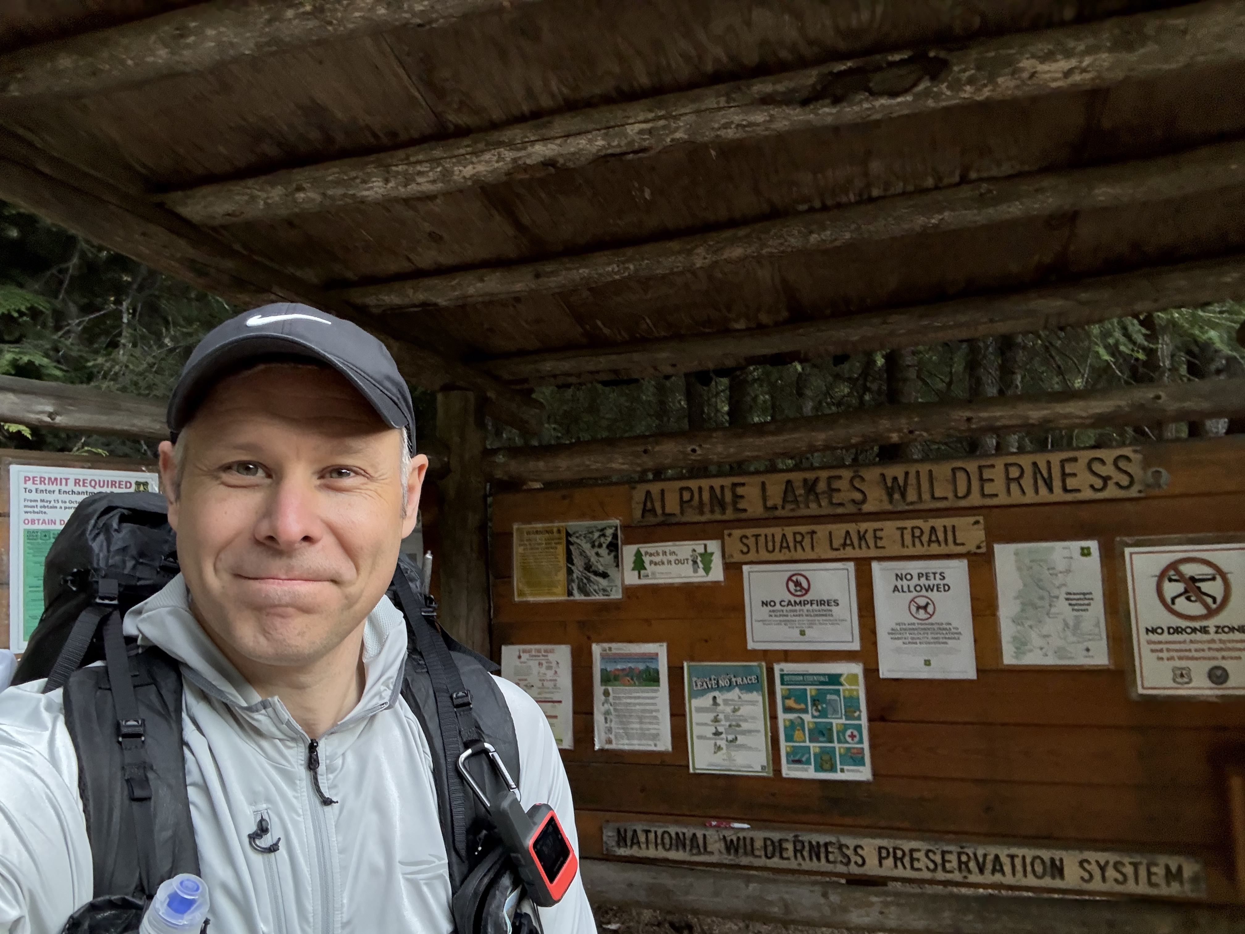
Stuart Lake Trailhead. The sign says ‘Permit Required.’ It really does.
The Climb to Colchuck
The hike up to Colchuck Lake was honestly perfect.
Gradual incline, beautiful water crossings, and the kind of trail that makes you feel like your training actually worked. I’d been hiking with a heavier pack leading up to this, and it paid off.
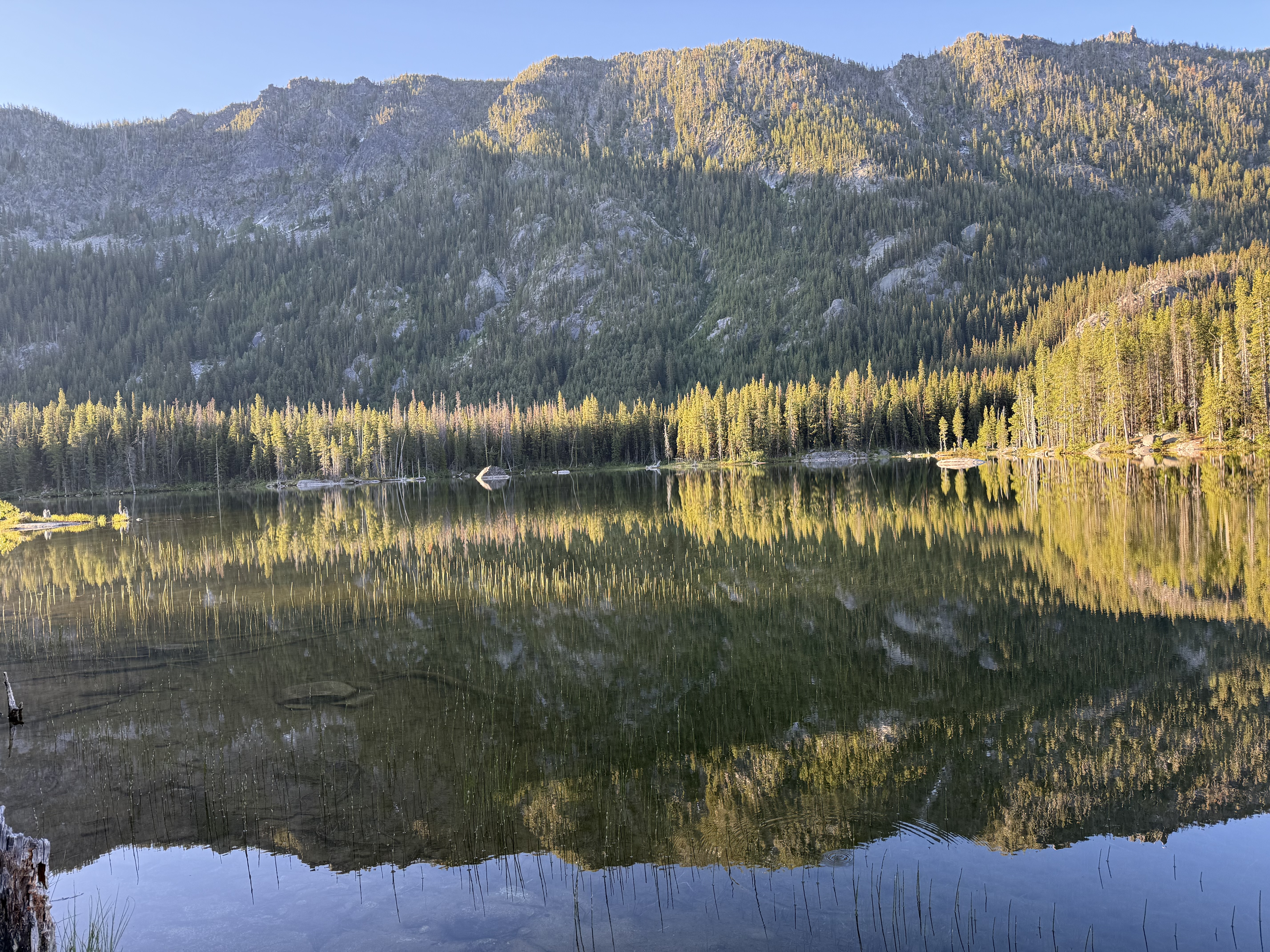
Colchuck Lake itself? Unreal.
I stopped, took in the view, and spent some time just shooting photos. The light, the color of the water, the scale of everything — it delivered exactly what the YouTube videos had promised. I could easily have set up camp there and called it a trip.
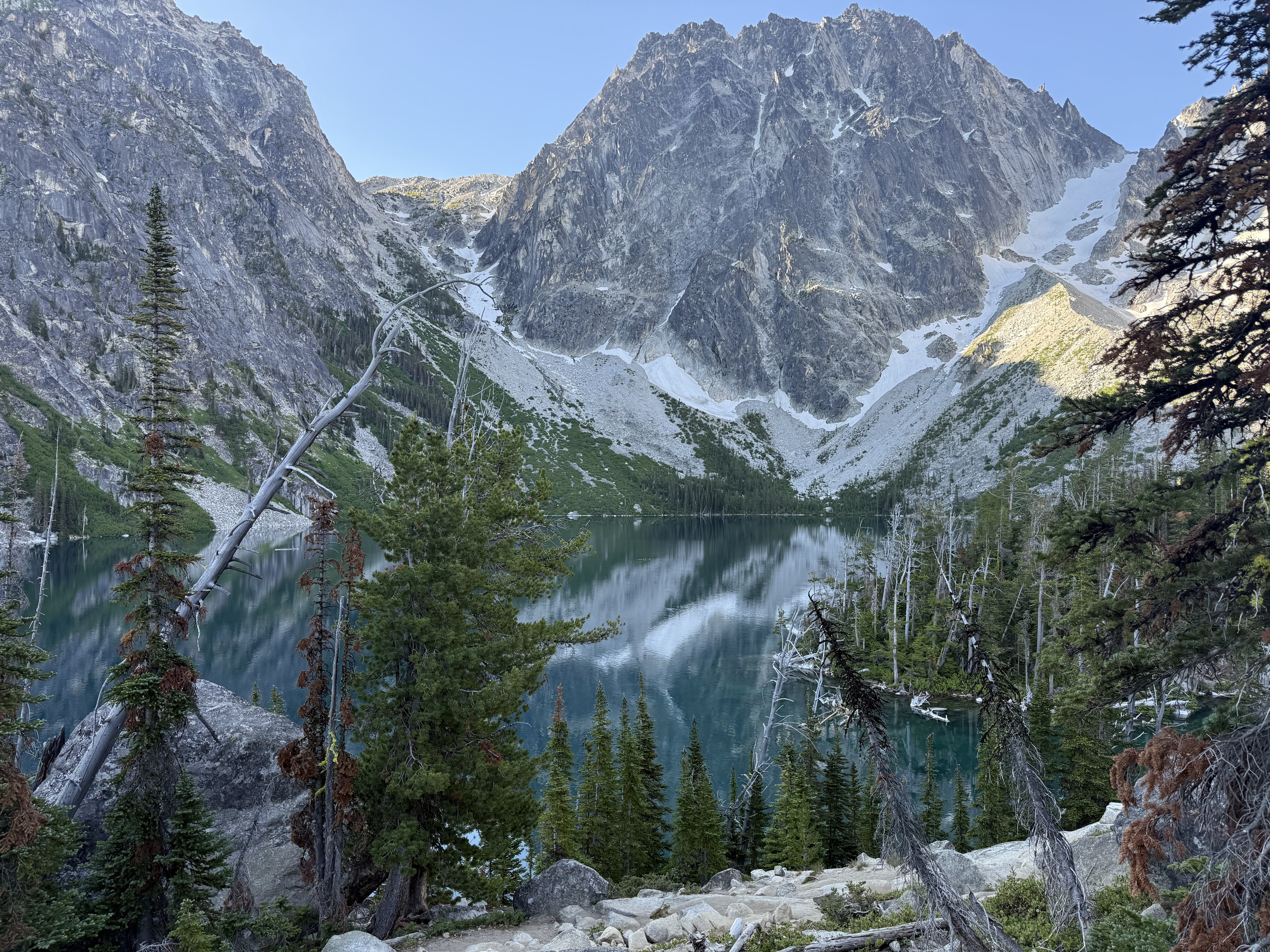
Colchuck Lake at 5,570 feet. I sat here longer than I should have.
But I hadn’t come this far to stop at the doorstep. The Core was the point.
I made a freeze-dried breakfast and coffee, sat with it for a few minutes, and then started the climb.
Aasgard Pass: Earn It
Aasgard Pass is exactly what everyone says it is. Steep. Technical. Mentally exhausting in a way that sneaks up on you.
What it isn’t is loose. This isn’t scree — it’s large, stable rocks worn smooth by years of heavy foot traffic. They don’t move. The problem is that every single step requires a decision: where do I plant this foot, what angle, which rock takes my weight next. For nearly a mile of near-vertical climbing, you’re constantly solving the terrain in front of you. By the time you’re halfway up, your legs are tired and your brain is equally fried.
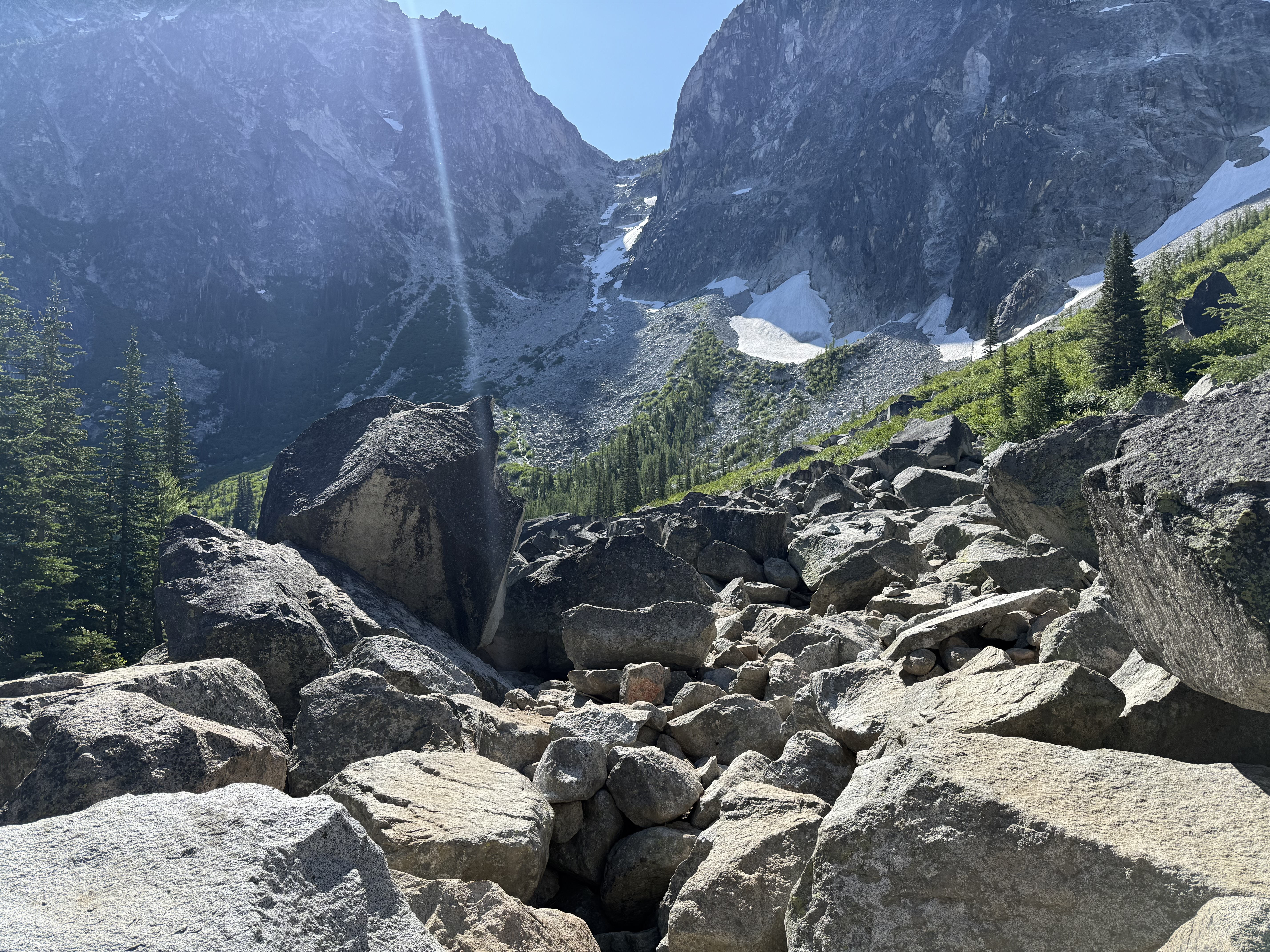
Looking up Aasgard Pass. Every step is a decision.
Hydration matters about a here than you’d expect. The climb is sustained enough that you need water on the way up, not just at the top — pack accordingly. About two-thirds of the way up there’s a spot to refill, which I took advantage of. That’s also where I spotted my first mountain goat — completely relaxed in terrain that felt very not relaxed to me.
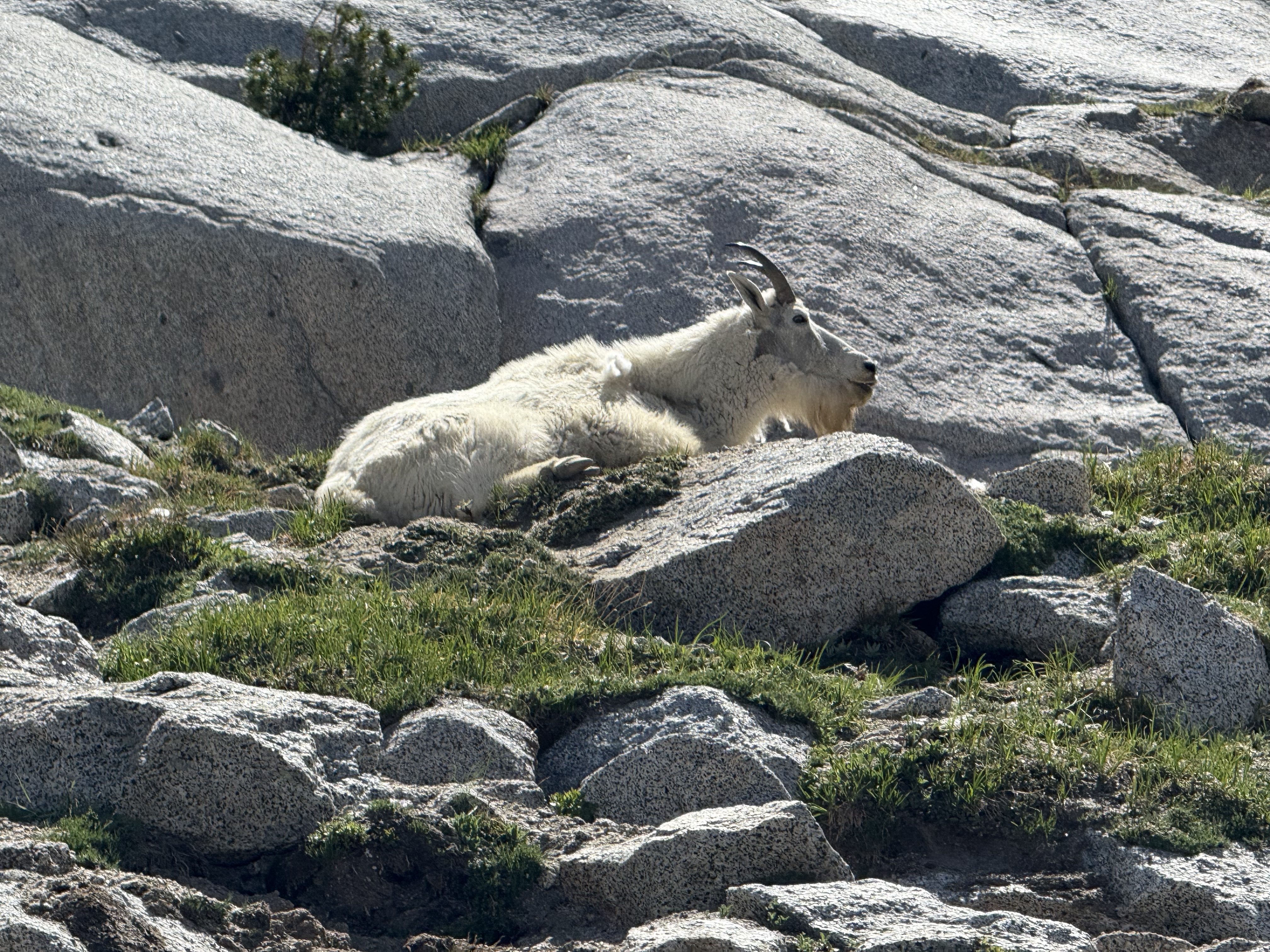
Completely relaxed. He was not impressed.
Eventually, I made it to the top.
And that’s when the Enchantments really opens up.
The Core: Beautiful, Windy, and Slightly Stressful
There was still quite a bit of snow in the Core in early July. Not dangerous, but enough to limit where you could move.
One thing that caught me completely off guard: pink snow. I noticed it in one spot and thought maybe I was just tired. Then I saw it again. And again. Turns out it’s a real phenomenon — watermelon snow, caused by a cold-adapted algae called Chlamydomonas nivalis that produces red pigment as UV protection. It’s common in alpine snowfields in summer. It even has a faint watermelon smell up close. Strange, beautiful, and one of those things you’d never expect to find at 7,500 feet.
Watermelon snow (Chlamydomonas nivalis). Not a filter.
Initial campsites were mostly claimed by the time I arrived, which added some stress. But I eventually found a spot between Inspiration and Perfection Lakes that was absolutely perfect — one of the best I’ve ever set up in.
I got my tent pitched, then hung my hammock with the bug net around it so I could lie down and actually decompress from the climb. Made a freeze-dried dinner, ate a Snickers bar, and watched the light change on the granite. Eventually settled into the tent for the night.
The stream between Inspiration and Perfection Lakes. My campsite was just above this.
Perfection Lake. The name holds up.
The ground was entirely rock, so staking out the tent wasn’t an option — I anchored the lines with rocks instead. First time doing that, and it showed. Lines slipped. Tension was off. It held eventually, but it wasn’t pretty.
Here’s what I should have done: looked out the car window the night before and connected the dots. The wind that kept me up at the trailhead was the same wind that lives up here. But it was completely calm when I went to sleep. I didn’t think to prep for wind. That was a mistake.
3:00 AM: Panic
I didn’t wake up to a gust. I woke up to sustained wind — probably around 100 km/h — blowing directly into my face.
I opened my eyes and saw stars.
Not in the inspirational sense. In the “my rain fly is gone and I’m staring at the open sky” sense.
My brain went straight to worst case: the fly had blown off entirely somewhere in the dark. But when I grabbed my headlamp and got out, it was still attached at one corner, flapping hard. I spent the next few minutes re-securing it with bigger rocks and tightening everything down — standing in my underwear, in the dark, on a granite slab at 7,500 feet, with the wind doing its best to remind me who was in charge.
It held for the rest of the night.
Worth noting: my sleep system — quilt, sleeping pad, the works — performed perfectly through all of it. Warm and cozy despite the wind howling outside. I genuinely wouldn’t have woken up at all if my face hadn’t been exposed. Something to fix next time.
That’s the memory that sticks most from Day 1.
🧭 Day 2: Beauty, Boulders, and Bugs
- ~6.27 miles
- ~5 hours (slow, technical terrain)
I slept in until around 8:00 am. Not great sleep, but better. Earplugs made a big difference blocking the wind noise.
Over breakfast, I made the call to shorten the trip to 3 days.
The Descent Begins
From Inspiration Lake to Lake Vivienne, the views are ridiculous.
Granite, water, alpine everything. Exactly what you imagine.
Then after Vivienne, the trail changes.
Technical Terrain
The descent gets more technical—boulders, rock slabs, route-finding. Progress slows way down. This wasn’t hard in a cardio sense, but it required focus.
And the mosquitoes started to show up.
Not terrible while moving, but the moment you stop, they’re there. Luckily, my gear worked well. I wasn’t getting bitten, so it made the trip much more manageable. It would have been absolute hell for me if my gear didn’t work.
Snow Lake: Camp 2
I made it to Snow Lake and found a campsite, then immediately found a better one near the water and moved. Definitely worth it, but the mosquitoes here were the worst of the trip. I got a few bites on my face and ankle—right where I wasn’t covered, and then I realized I had forgotten my Benadryl itch stick. Not ideal.
Snow Lake, Camp 2. The mosquitoes approved of the location.
By 6:00 pm, I was in my tent just to get away from the bugs.
That became the pattern: move during the day, retreat at night.
🏁 Day 3: The Long Way Out
- 7.65 miles
- 4 hours 30 minutes
- ~4,000 ft descent
I woke up to a genuinely beautiful morning. Clear sky, still air, Snow Lake catching the early light. Nothing quite like standing at a backcountry lake with a hot coffee in your hands, completely alone with that view.
The mosquitoes were also there. They do not care about your moment.
Snow Lake at sunrise, Day 3. Coffee in hand. Mosquitoes in attendance.
I got packed up, accidentally warped my insulated titanium mug by putting it directly on the stove to “sterilize” it (a bold move that did not pan out), and mentally prepared for the final push out.
The Misleading Map
Before leaving camp I checked the map and did some quick math. Snow Lake to the trailhead looked like 4–5 miles, mostly downhill — a few easy hours and I’d be done.
It was 7.65 miles.
I don’t know what I was looking at, but the actual distance was nearly double what I’d estimated. A useful reminder that “mostly downhill” and “easy” are not the same thing, especially at the back end of three days.
The harder part is psychological. When you’re at mile 4 and you pull out the map expecting to see the trailhead close, and instead you see you’re barely halfway — that’s a moment that requires active management. You have to make a conscious decision not to let it sink you. The miles don’t get longer because you didn’t expect them. You just put your head down and keep moving.
Snow Lake → Nada Lake
This section opens with another boulder field — the same deliberate, careful movement as the Core, just lower elevation and warmer. Progress is slow by necessity. Nada Lake appears partway through and it’s beautiful enough that I understood why people camp there. In hindsight it would have been a solid option, but I hadn’t been willing to gamble on availability when I was making decisions earlier in the trip.
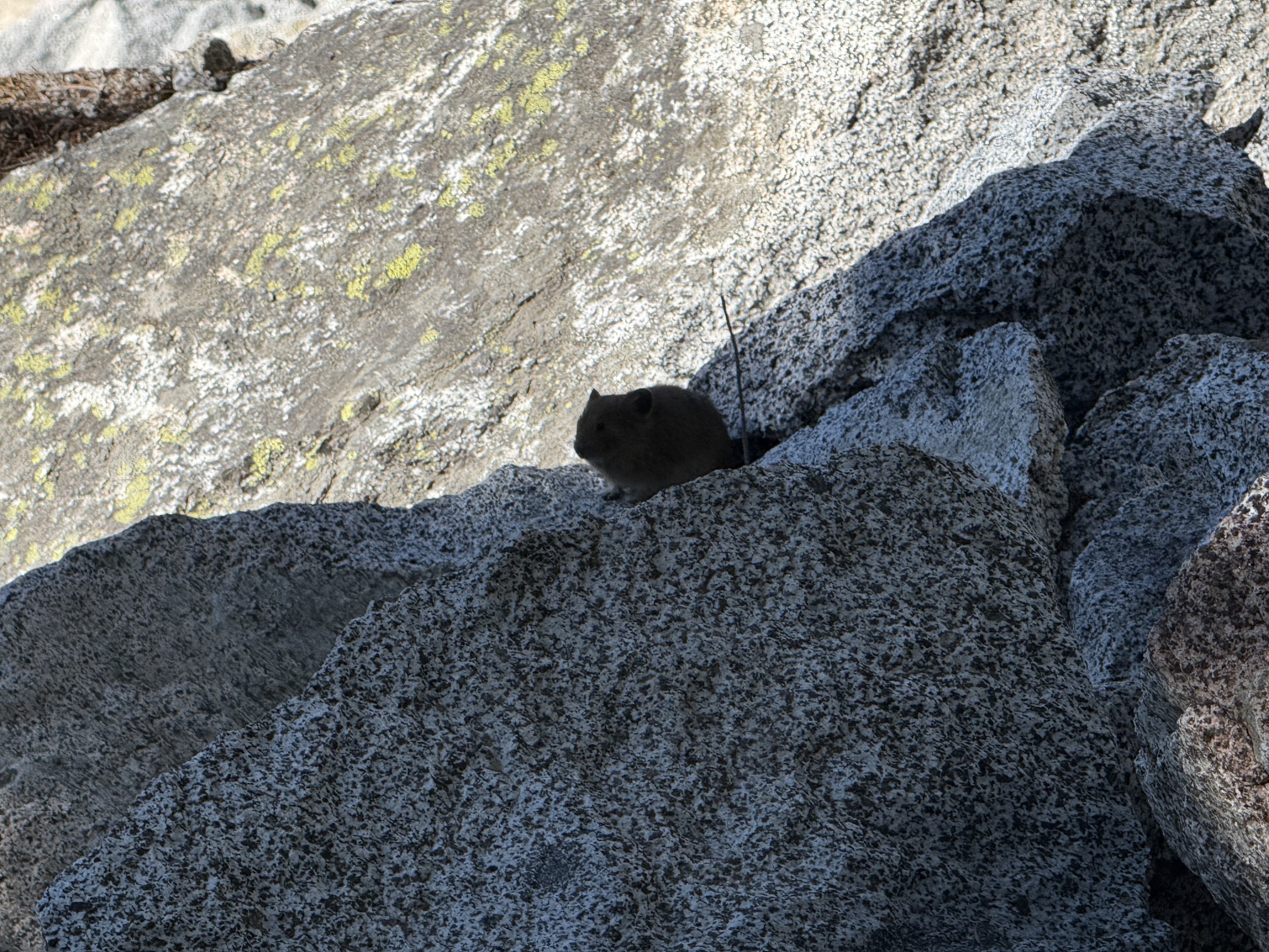
A pika keeping watch on the descent. He seemed unbothered by the distance remaining.
The Water Moment
Somewhere in this stretch I’d planned to refill at a water crossing marked on the map. When I got there, it was dry. Not low — just gone.
That particular flavor of stress is hard to describe. You’re miles from the trailhead, it’s hot, and the thing you were counting on isn’t there. I kept moving and found another creek not far ahead, where I filled everything — SmartWater bottle plus two 1L bladders. It was warm out and I needed all of it.
The lesson I took from this: map out your water sources for the entire route before you leave, not just the ones you think you’ll need. When you know exactly where the reliable fills are, you can calibrate how much you carry at each stage — lighter when water is close, topped up when there’s a longer dry stretch ahead. It’s a simple planning step that removes a lot of unnecessary anxiety on the trail.
The Final Stretch
After Nada Lake, the trail becomes classic Pacific Northwest — roots, dirt, smaller rocks, easy to follow. Technically straightforward. After three days of cairn navigation, boulder fields, and technical descents, you’d think that would feel like relief.
It doesn’t, really. After everything you’ve seen in the Core — the lakes, the granite, the alpine everything — this section just can’t compete. That’s not a knock on the trail; it would be beautiful on its own. It’s just that you’ve been spoiled. The scenery fades to forest and the miles stretch out, and it becomes a grind in a way that the harder sections never did.
You stay positive. You keep moving. You remind yourself that the trailhead is at the end of this, not somewhere else.
Eventually, I made it back.
Changed clothes. Called Woosun. Drove straight to Dairy Queen for a Peanut Buster Parfait.
That felt earned.
🧠 What Worked
A few things made a huge difference:
- Full coverage clothing (Sitka hoodie + Kuhl pants) → mosquitoes couldn’t bite through
- Leukotape → fixed hot spots immediately
- Training with a heavier pack → made Day 1 manageable
- Earplugs → dramatically improved sleep
- Simple, filling meals → reduced the need for constant snacking
- Sugar + protein snacks → candy for energy, beef sticks for balance
❌ What Didn’t Work
Some things I wouldn’t bring again:
- Ultralight backpack (Zpacks Arc Haul) → serious chafing, not worth it
- Mosquito repellents (Thermacell, Flextail) → didn’t work at all which was surprising given the reviews, and disappointing as I carried them hoping they would provide some relief from the bugs.
- Fragile tent (Nemo Hornet Elite) → took damage in wind, but most likely due to the way that I set it up.
🍽️ Food Lessons
I packed way too much food.
I expected ~3000 calories/day. I probably ate closer to 2000.
What I learned:
- Big meals > constant snacking
- I didn’t crave trail mix at all
- Candy + simple carbs worked well during effort
- Protein snacks (beef sticks) were valuable
- Accessibility matters (jerky in one big bag = mistake)
💡 What I’d Do Differently
If I did this again:
- Mark reliable water sources ahead of time
- Bring a more comfortable backpack, even if heavier
- Use a more durable tent for exposed conditions
- Switch to a thicker sleeping pad (side sleeper reality)
- Consider a 30-40° quilt for summer trips
- Simplify food and bring less overall
- Dial in a better electrolyte system (less waste, more consistency)
🧭 Final Thoughts
The Enchantments lived up to the hype.
But not just in the Instagram way.
It’s not just beautiful—it’s demanding. It asks you to solve problems, adapt, and stay aware. Wind, bugs, terrain, water… they all shape the experience more than you expect.
And that’s kind of the point.
I’d absolutely do it again.
Just… a little smarter next time.