The rain started somewhere around mile 3. I know this because that’s when Basil stopped investigating every fern and started giving me the look — the one that says you said this was going to be fun.
It was still fun. Just wet.
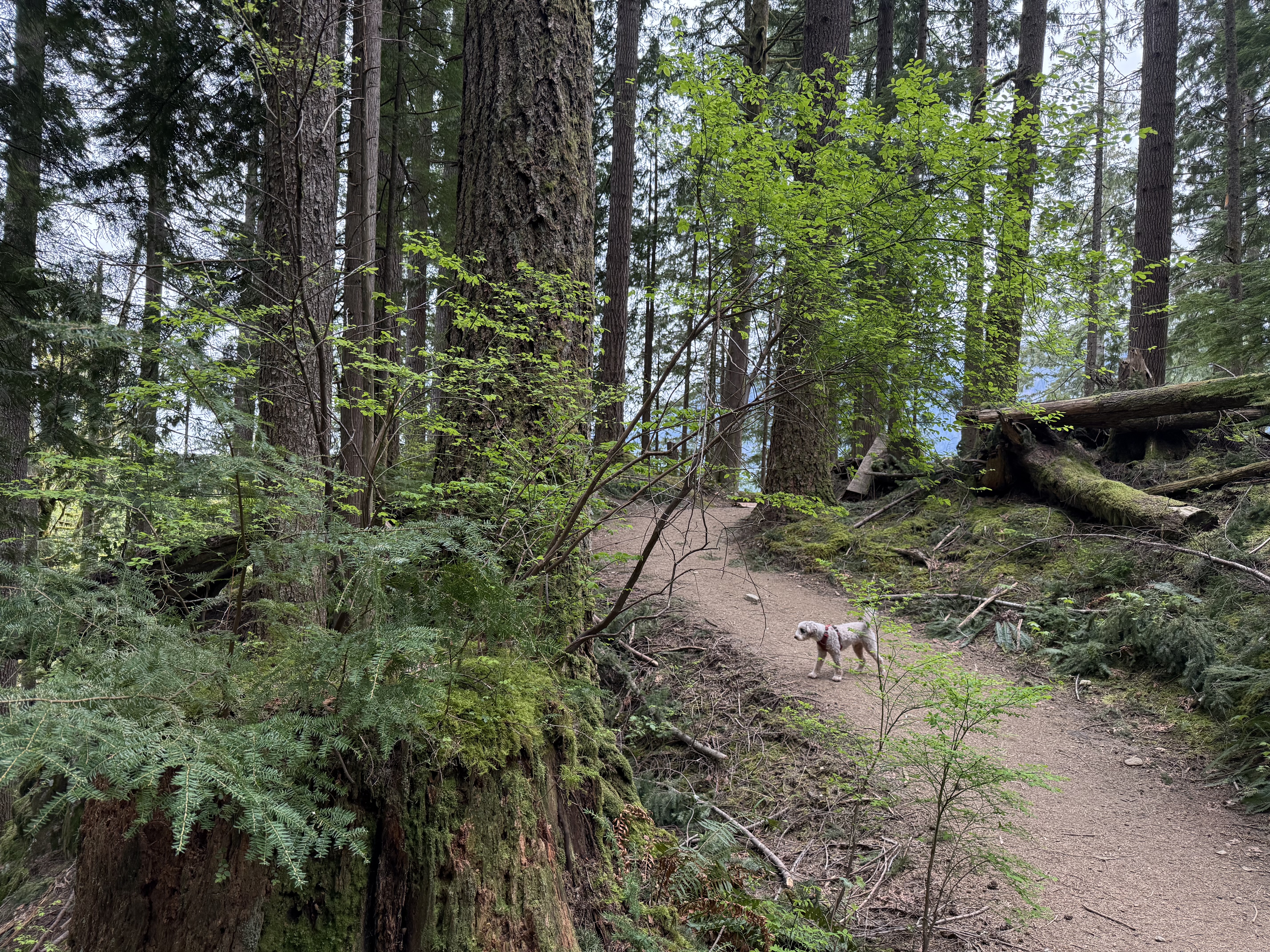
The lower trail. Basil still optimistic at this point.
The Setup
Granite Creek Trail (also listed as Granite Lakes Trail on AllTrails) is a Middle Fork Snoqualmie Valley hike that most North Bend regulars know about but fewer do — probably because it doesn’t top any “best views” lists, and the trailhead is 50 minutes from Issaquah on SE Middle Fork Road. I did it on a Tuesday. No other cars at the trailhead. NW Forest Pass required.
Stats: 8.4 mi RT | 2,400 ft gain | Moderate | Dogs allowed (leash)
I had my Durston Gear Kakwa 55 pack at 35 lbs and Basil on leash. Out by mid-morning under an overcast sky that had “it’s going to rain” written all over it.
The Lower Trail
The first two miles are legitimately the best part of this hike — which is either an endorsement or a warning, depending on why you’re here.
Granite Creek runs alongside the trail for most of the lower section. You can hear it before you see it, and in late April it was running full and loud. Ferns everywhere. Huckleberries growing out of old stumps. The kind of dense PNW forest that makes you forget you’re 50 minutes from a Costco.
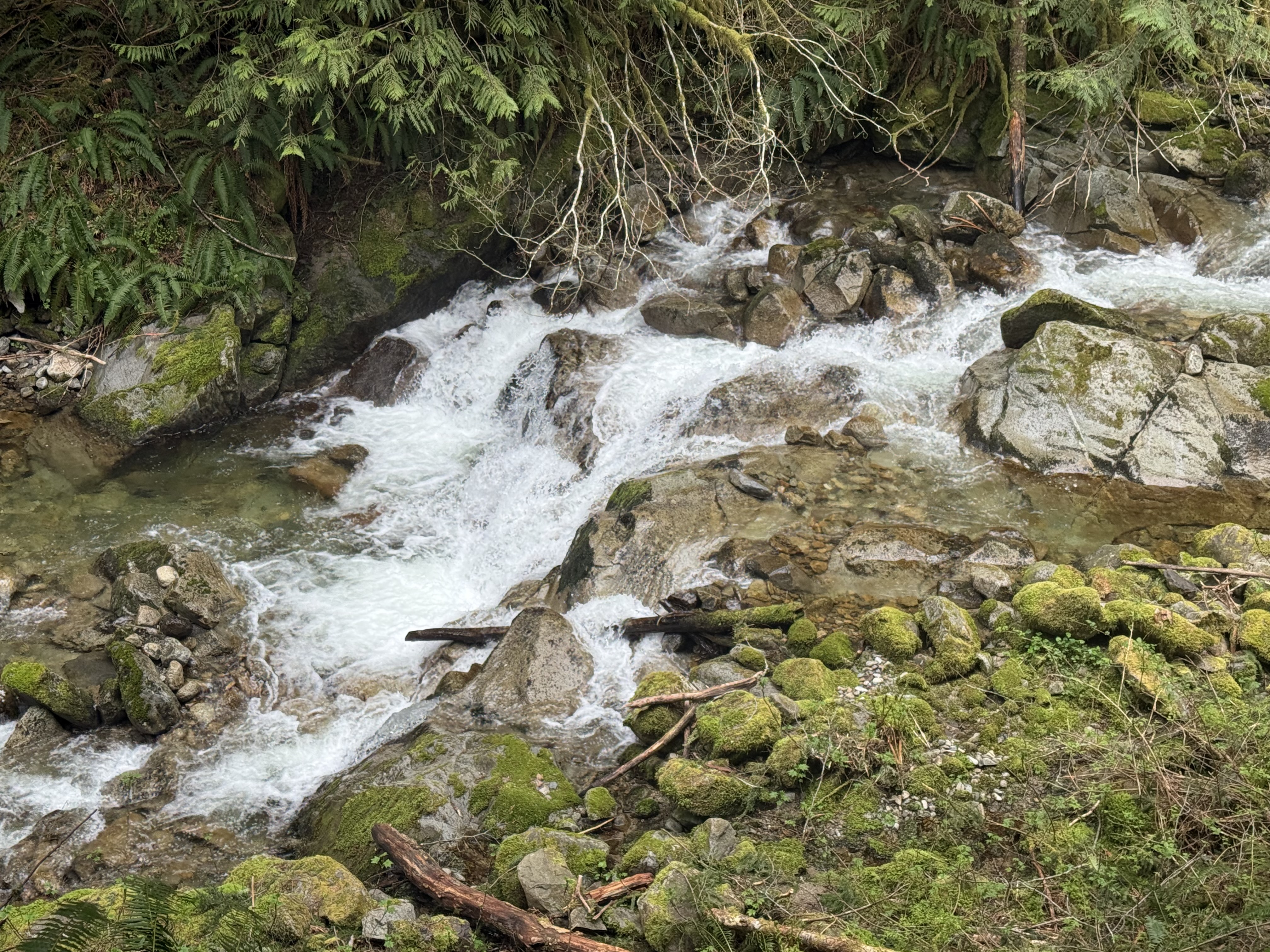
Granite Creek running full in late April.
Basil conducting his standard moss audit.
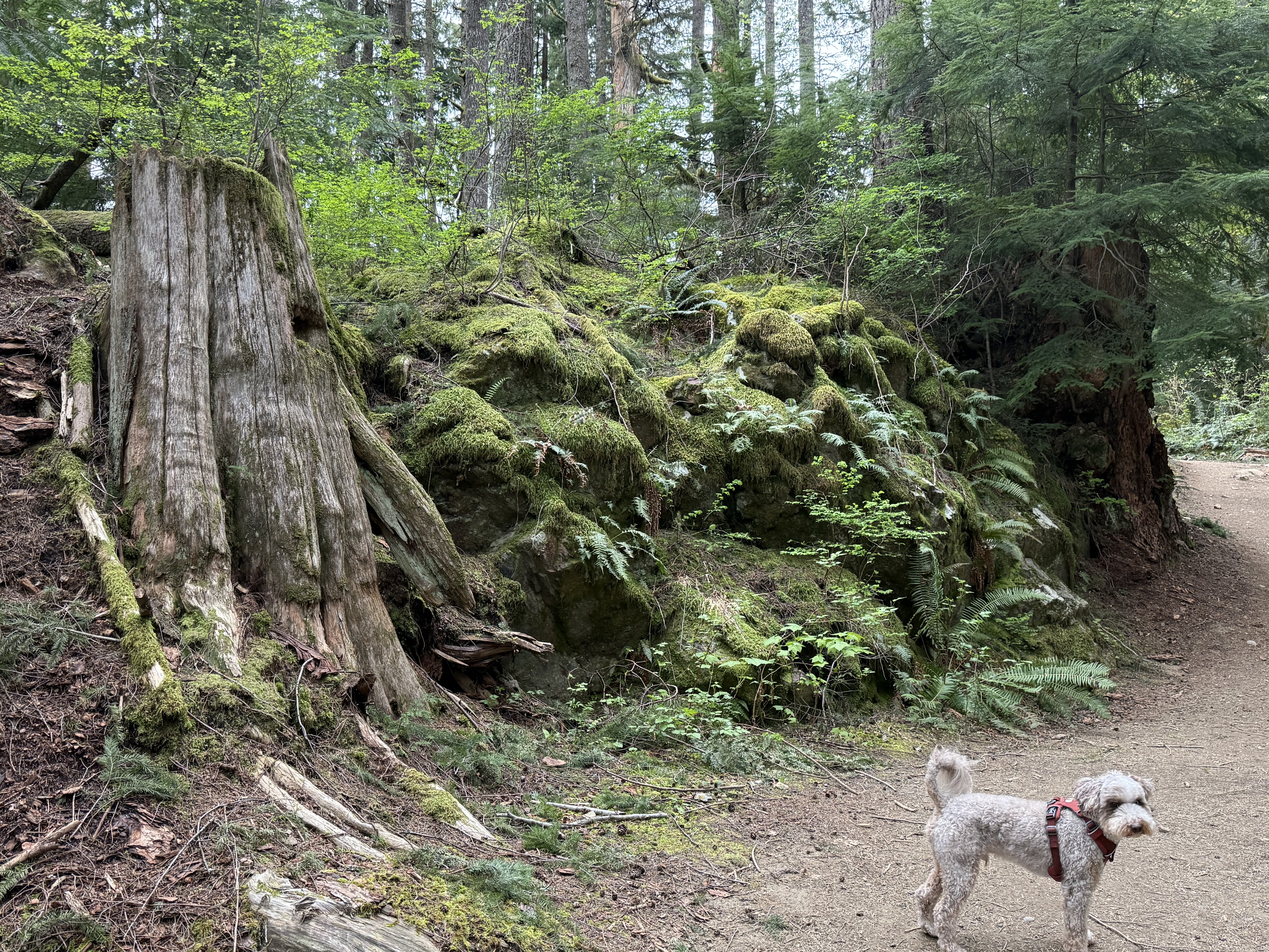
The old-growth stumps along the lower trail are worth stopping for. Some of them are wide enough to park a car on. They don’t let you forget what used to grow here.
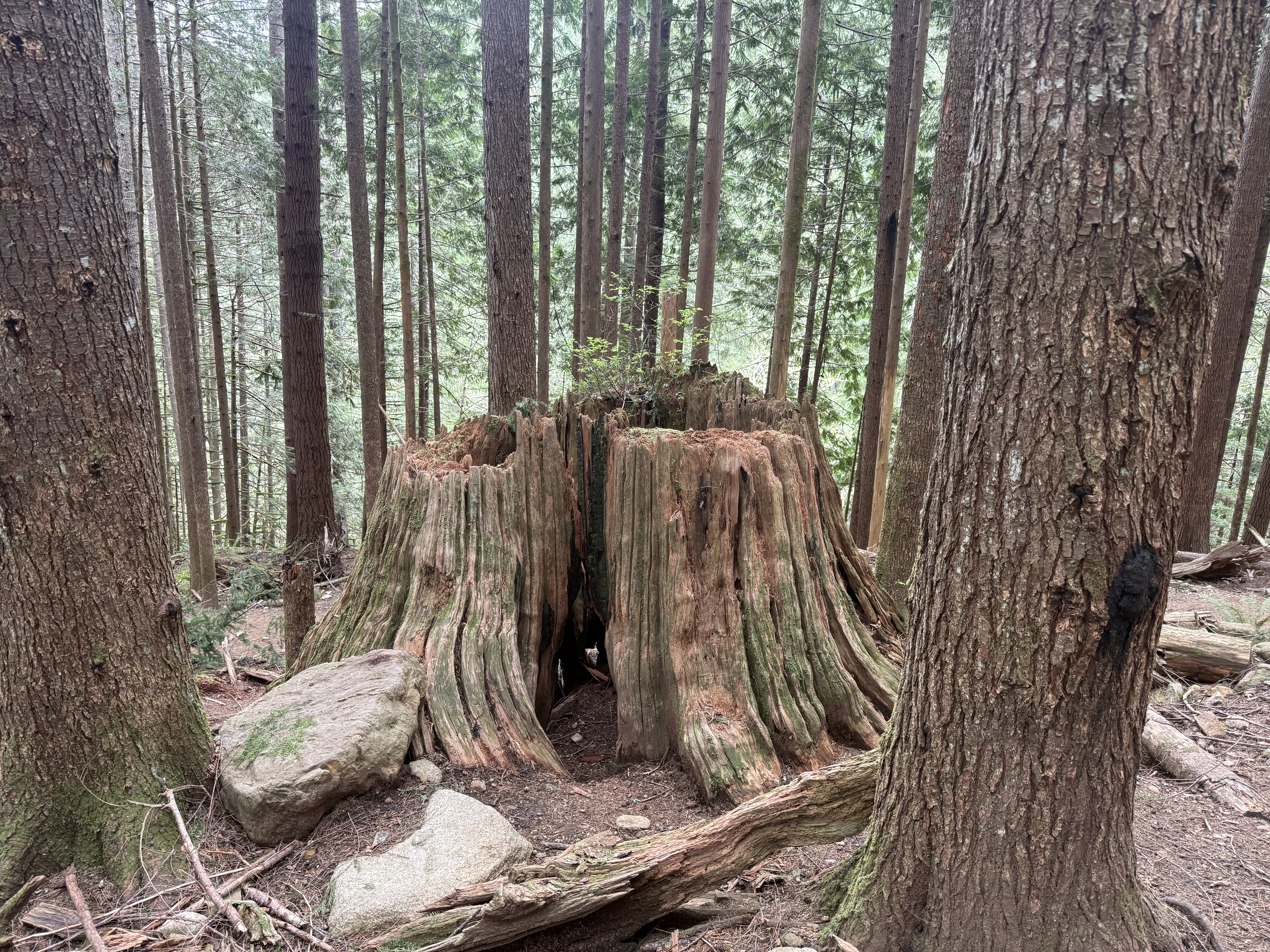
The forest is slowly reclaiming what it lost.
The Climb
The trail description says “moderate,” which is accurate but incomplete. There’s nothing technical about this trail — no scrambling, no exposure — but there’s also no flat section for 4 miles. It’s just sustained uphill, start to finish. Nothing steep, just relentless. Good for training. Humbling in the rain.
The mist started around mile 3. Consistent rain by the time we hit the upper trail. Above the treeline, the valley opens up in an unusual way: dense dark forest on the left side, a brighter more open stretch to the right. In good conditions it probably reads as scenic. In fog and rain it read as dramatic.
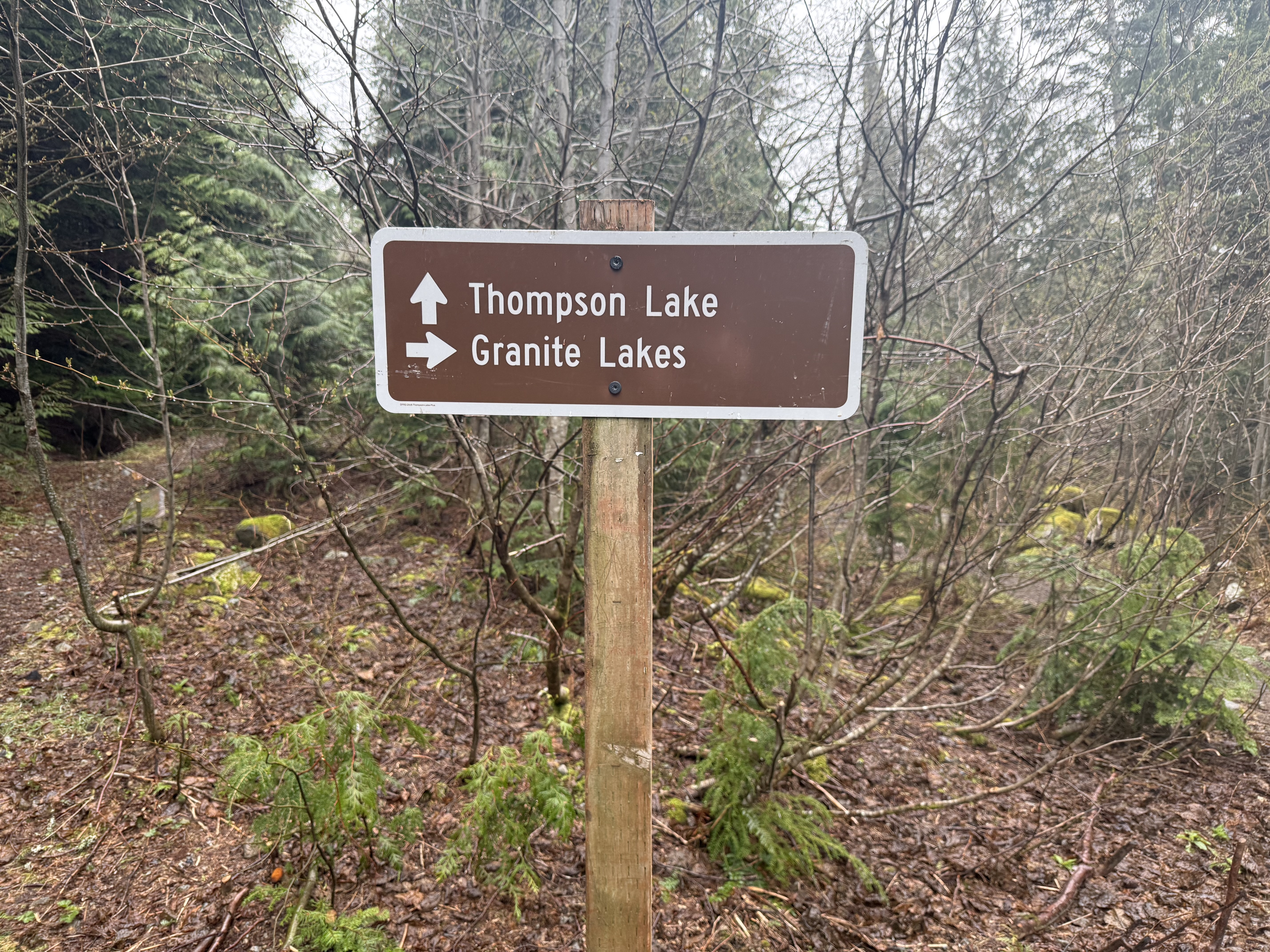
The junction for Thompson Lake and Granite Lakes. Kept right.
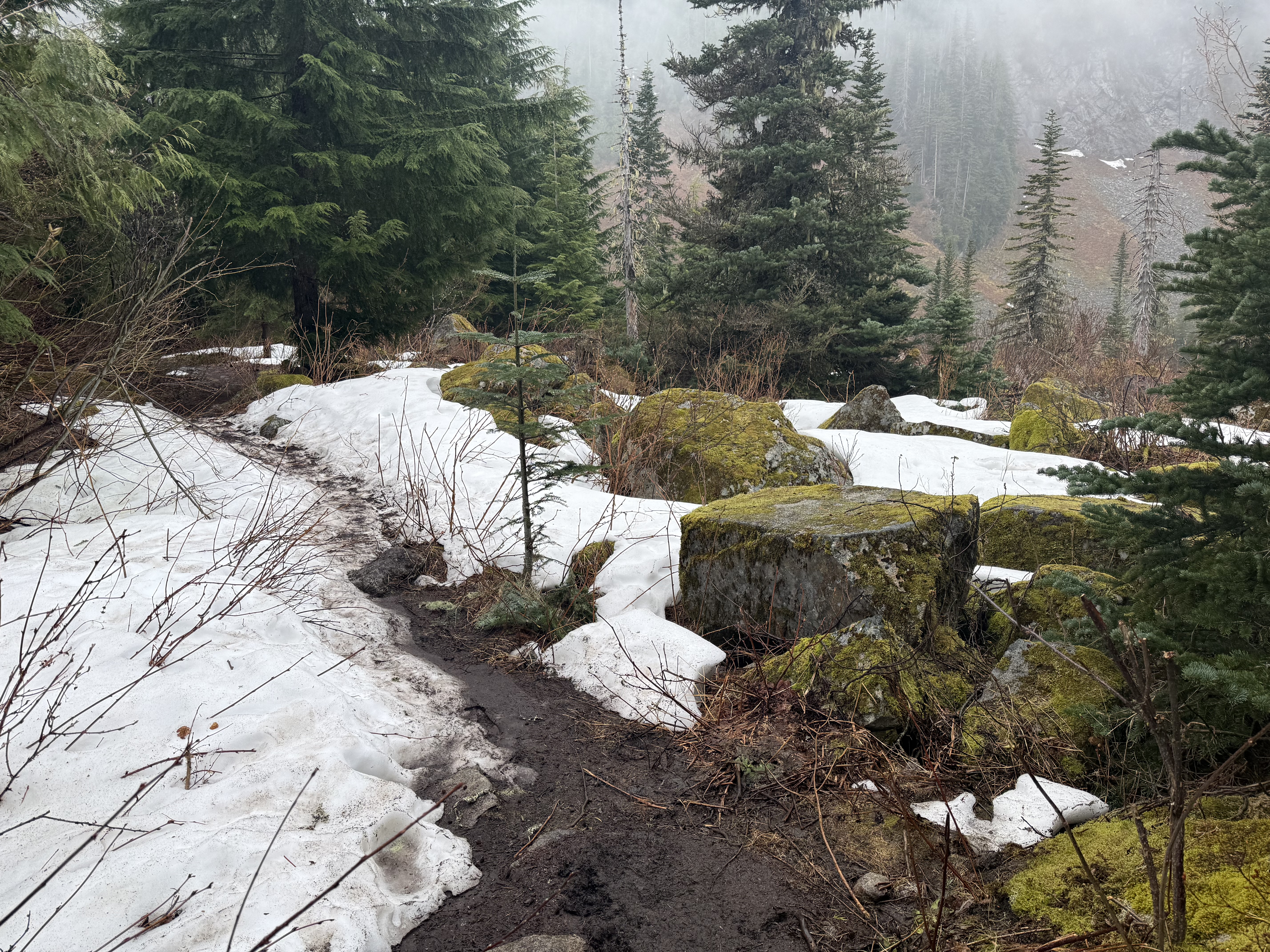
Snow lingering near the top in late April. Passable without microspikes, but sloppy.
The upper section had meaningful snow patches. Passable without microspikes, but the footing got wet and unpredictable — soft snow over waterlogged trail. Worth knowing if you’re planning a trip in early May.
The Lake
The lake at the top is genuinely beautiful. Dark water, snow on the rocks, fog drifting through the surrounding ridgeline. In better weather it would be a great spot to sit for an hour.
At 8.4 miles with 2,400 feet of gain, the payoff-to-effort ratio is honest but not exceptional — the Middle Fork corridor has trails that hit harder scenically for similar work. I stayed long enough to appreciate it, then turned around. The descent in the rain was uneventful. Basil was soaked through by the time we hit the car.

Basil’s post-hike assessment. Asleep before I merged onto I-90.
Gear Notes
Rain shell: The Sitka Dew Point LT held up well while moving. The problem was everything underneath — already damp from sweat and mist before the real rain started. There’s no fix for that except a puffy for rest stops, which I didn’t have.
No puffy: The Arc’teryx Delta fleece was enough while moving, not enough standing still at a cold, windy lake. A packable puffy is mandatory for any shoulder-season hike where the summit is above 4,000 ft.
Wind shell outside the pack: I had it clipped to the outside of the pack. It was soaking wet before I ever reached for it. Keep it inside the main compartment.
Gloves: I left them home. Hands went numb on the descent. Poles helped, but not enough. I own gloves. I need to just use them.
Basil: He got wet and cold on the way down. He needs a rain jacket for any hike with real precipitation above treeline. This one was obvious in retrospect.
Body Glide: Worked. Zero chafing at the left hip under a 35 lb load for 8 miles. Pre-hike checklist item, permanently.
The Verdict
6/10. A good training hike that knows what it is. The lower trail through the forest — the creek, the ferns, the old stumps — is worth the drive on its own. But this isn’t a destination hike. The lake doesn’t quite close the deal for the mileage, and it’s not a trail you come back to for the views.
What it is: 30 miles from home, empty on weekdays, and 2,400 feet of gain at 35 lbs is never wasted effort. If you’re conditioning for something bigger and want to be alone with your thoughts and your dog, it delivers.
Basil was asleep before I merged onto I-90.